Water Features Built for Long-Term Function
Pond Building in Hot Springs for property owners planning recreational or agricultural water features
Atlas Excavating creates custom ponds designed around your property's specific drainage patterns, soil composition, and intended use. Whether you need a pond for livestock watering, irrigation storage, wildlife habitat, or recreational fishing, the excavation process begins with evaluating how water moves across your land and where natural drainage converges. In areas with clay-heavy soils common throughout central Arkansas, pond construction requires shaping basins that account for seasonal water table fluctuations and erosion control along shorelines.
Pond excavation involves more than digging a hole—it requires calculating watershed area to determine sustainable pond size, establishing proper depth zones for different water temperatures, and shaping slopes that prevent bank collapse during heavy rain events. The site must also account for overflow management so that extreme rainfall doesn't wash out berms or flood adjacent areas. Each pond is graded to create distinct depth zones: shallow littoral areas where aquatic vegetation can establish, moderate depths for fish habitat, and deeper zones that maintain cooler water during summer months.
Schedule a pond construction consultation to evaluate your property's topography and water flow patterns.
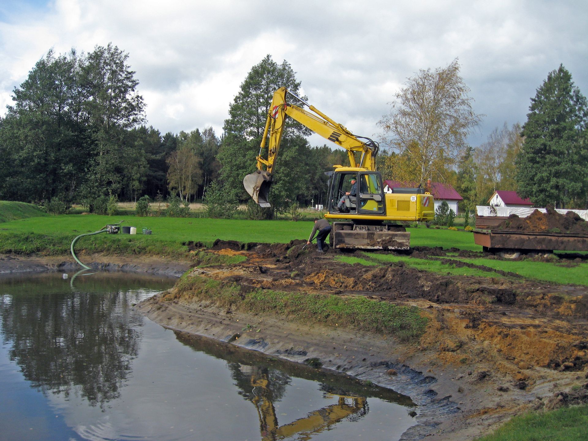

What Proper Pond Construction Requires
The excavation process begins with clearing vegetation and topsoil from the footprint, then shaping the basin according to planned depth contours and slope grades. Soil removed during excavation is compacted into berms around the perimeter, creating raised embankments that contain water and provide structural integrity. Compaction happens in layers—loose soil piled haphazardly will settle unevenly and develop leaks, while properly compacted material creates a stable barrier that holds water season after season.
Once your pond is complete, you'll notice water beginning to collect in the basin as groundwater seepage and surface runoff fill the excavated area. The shoreline remains stable during rain because slopes are graded between three-to-one and four-to-one ratios, preventing erosion while allowing safe access for livestock or equipment. Overflow structures direct excess water away from the berm, so heavy storms don't compromise the embankment or create uncontrolled flooding downstream.
Site finishing includes shaping spillways that handle overflow, smoothing access paths for maintenance equipment, and establishing vegetation on berms to prevent erosion. The final grade around the pond perimeter should direct surface runoff into the basin rather than allowing sediment-laden water to wash across bare soil. Properly finished ponds settle into the landscape and begin supporting their intended function—whether that's providing water for agriculture, creating fish habitat, or adding a recreational feature to your property.
Common Questions About This Service
Property owners often ask about site requirements and construction timelines before starting pond projects.
What site conditions affect pond construction?
Soil type determines how well the basin will hold water—clay soils create natural sealing, while sandy or rocky soils may require additional compaction or liner material. Drainage patterns across your property determine where the pond should be located to capture runoff without causing erosion.
How is pond size determined?
Watershed area dictates sustainable pond size—you need enough rainfall and runoff to keep the pond filled during dry periods. A pond that's too large for its watershed will drop to shallow levels during summer, while proper sizing maintains consistent depth year-round.
What does site shaping involve?
Excavation creates depth zones ranging from shallow edges to deeper centers, typically eight to twelve feet at the deepest point for recreational ponds. Removed soil is compacted into berms that contain water and provide elevated areas around the perimeter.
Why does slope grading matter?
Banks graded too steeply will collapse during heavy rain or when livestock access the water, creating sediment buildup and unstable edges. Proper slopes between three-to-one and four-to-one allow safe access while preventing erosion that clouds water and reduces pond lifespan.
When should pond construction be scheduled?
Late summer and fall provide drier soil conditions in Hot Springs, making excavation more efficient and allowing compacted berms to settle before spring rains begin filling the basin. Drier conditions also reduce equipment rutting and site disturbance during construction.
Atlas Excavating plans each pond project based on your property's unique drainage characteristics and intended use. Contact us to arrange an on-site evaluation of your land's topography and soil conditions.